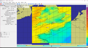
It is suggested that you should also get an app that enables you to read GRIB files. For more information, consult Frank Singleton’s weather page (click here)
My current GRIB viewer is zyGrib. Click here for more information and download. This is particularly useful where you are receiving internet abroad and may be subject to roaming charges; or are unable to receive Internet and have to rely on SSB radio or satphone.
More about Weather….
 Whatever the Weather
“Will it rain today?”; “Will it be rough outside the Harbour this afternoon?”; “if I go to Yarmouth this weekend, will I be able to make the passage back on Monday morning, or do I need to come back on Sunday afternoon?”
These are real questions that we seek to answer. In one sense, the available weather forecast data and its accuracy has improved beyond all measure in the last few years. The downside is that there is just so much weather information that it can be difficult to find what you want, and to assess its reliability.
We interpret these human questions into technical ones that relate to wind strength and direction, precipitation, visibility, waves, swell, and tides. A lot also depends on the type of passage we are making in terms of immediacy, time and distance. Sometimes we simply want to know whether it will be raining when I get the dinghy out to go to the mooring this afternoon. At the other end of the scale we could be planning a transatlantic passage. These notes concentrate on the needs of coastal passage making, but with a few comments on wider range cruising.
Such technical knowledge of weather as I possess has been gleaned from the books od Alan Watts, including
The Computer Data is analysed into text forecasts such as our beloved shipping forecast, and inshore waters forecast, both available in audio from BBC and by VHF from the UK Coastguard, and in text form by Navtex or on the Internet. Apart from official presentations or weather charts stretching up to 10 days ahead, there are numerous different presentations on the Internet. Some of my favourites include Ventusky, Netweather, and Passage Weather.
One great source of live data is grib files. These massively reduce the amount of data downloaded, which can be a consideration, especially when abroad. To make use of Grib files you will need an app on your phone or computer. I use SailGrib Free on my phone and Zygrib (which is also free) on my laptop, Zygrib can cover wind, waves, swell, precipitation, temperature and cloud cover. The presentation is colourful and highly suitable for Logs. I have prepared a short video on how to use gribs that can be viewed by clicking here
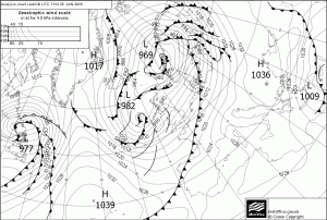
All of these presentations are derived directly from the computer models, and share one common attribute. None of them show the location of the weather fronts.
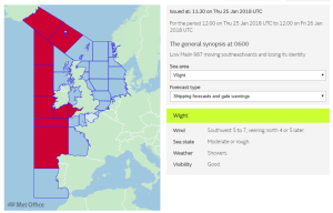
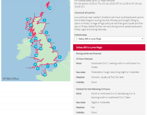
For reasons I do not understand it seems that computers are still not clever enough to draw the fronts on the weather maps. For this reason it is often quite important to refer to official GMDSS sources such as the UK Met office when the synoptic charts have been reviewed by human beings, and the fronts have been added. These are important because they tell you where the wind is likely to be gustiest. Often this is more important when looking ahead for the next 24 hours, whereas other presentations may be better when looking further ahead. In particular, for European waters, the European Centre for Medium Range Weather forecasting (ECMWF), of which the UK met office is a major partner, publishes forecasts that are freely available for up to 10 days. This is very useful when planning the next week of your cruise. However, I often find that Netweather, which publishes data for the same distance ahead is easier to use.
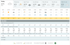
If you are happy with data rather than a weather map, there is little to beat the weather widget produced by the UK met office, which you will find on many websites, (See above set to Cowes, in the middle of the Solent, but that can be changed). Click on it and a whole meteogram for that location for up to 7 days ahead will open up.
Until recently I had been relying on Passage Weather for forecast of waves and swell. I shall probably get the same information from Zygrib in future. It is important to understand the distinction between waves and swell. Swell is a persistent wave pattern, often with a period of many seconds and heights that can range from zero to several metres. It is the result of mid ocean storms that will have occurred several days earlier. For this reason it is more apparent on the West Coast of the United Kingdom and to some extent in the English Channel, particularly on the French Coast. The direction is usually between northwest and southwest. Indeed, during some years that we have cruised to Biscay, there has been a persistent swell of between one and two metres virtually all summer. The swell in the North Sea will mainly be the result of depressions off Norway and will result in a swell from the north. On the other hand, wind waves are the results of local weather, and can be created from any direction within a few hours, and can sometimes start from a new direction as a result of a wind shift, leaving the previous wave pattern in existence. Indeed, the disaster that was the 1979 Fastnet race largely arose as a result of a major wind shift which resulted in two wave patterns on top of an Atlantic swell. It is not surprising that Meteo France, and to a lesser extent Met Eirann, are the best weather services for reporting waves and swell. Note also that Zygrib makes the distinction as well, and – like Passage Weather – has worldwide coverage.
In many coastal areas, weather stations run by harbour authorities or local businesses publish their data live on the Internet. For short coastal passages, such “Now Casting” information is invaluable, and can affect the decision on whether or not to leave the marina or drop the mooring. The buttons above give links to such information for many sites in the Solent area, and as far west as Portland.
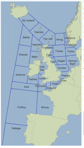
The BBC shipping forecast is an institution treasured by many, including a lot of people who have never been to sea. When delivered well it has an almost poetic quality. The full forecast, including reports from coastal stations and the inshore waters forecast occur at inconveniently early and late hours, but are probably the most up to date information but you’ll ever get about the weather in your area. You can even draw your own weather map from the information!
Until recently, it was important for those of us who do not want to get up at 0520 to have Navtex. This broadcasts on two frequencies. 490 kHz is the frequency used for the main shipping forecast, and 512 kHz is the one used for more local forecasts. When I had Navtex fitted, I used to try and switch to 490 kHz overnight, and leave the set tuned to 512 kHz during the day. Although I kept the Navtex when I sold the yacht I have not yet fitted it on Teal, largely because I have such good Internet access in the Solent area. In any case, the important part of the forecast is repeated by HM coastguard at 0730 (and every 3 hours thereafter) and I am usually up by then and can write down the forecast using the shorthand that I described in the previous article. That has the advantage that it goes straight into the Log and provides a useful permanent record, and does not rely on an Internet connection.
If you are going to write up the narrative Log of your cruise it is important to save the forecast information. While away on a cruise, I usually try to save at least one weather map each day, and once a week I will try to save a series of forecasts for 10 days ahead, which will remind me of my thinking and forward planning at the time when it comes to writing up a Log. Mostly I get the weather map I want on the screen and take a ‘screen grab’ (usually alt-prntscrn on a PC). This places the screen image on the clipboard of your computer. It can then be placed anywhere that you can paste an image. I usually drop it into my image processor (I use Serif Affinity Photo) and save it in a special weather map directory with a filename of the form yyyymmdd-x. So if, on the 22 July 2018, I am recording the third weather map of a series looking several days ahead the filename would be 20180722-3. More simply, you can paste it into a Word document. You will then be able to find it easily when you come to assemble the Log. If you do not have a computer on board, and are using (say) a tablet or phone to look at the weather, then the best thing to do is to email the weather map to yourself. You can then download it when you get home.
Just occasionally, you may be in a situation where there is no Internet access, but a weather map included in your narrative Log would be incredibly useful. That happened last year when we were anchored in Studland Bay, so I took a photograph during the TV weather forecast of the little television screen which we carry on Teal.
As a backup, I always look for a local newspaper. In France the France Ouest newspaper has a wonderful full page article each day. These may have a wonderful headline worthy of inclusion in a narrative Log. One of my favourites, as the weather started to go downhill after a long, hot spell was “Le soleil a perdu l’exclusivite” or “The sun has lost exclusivity”. Each time I bought the paper, I tucked that page away in a locker for use when I came to assemble the Log later in the year.
In France, I rely on the French forecasts. On VHF these come from Cross Corsen, and are very informative. But you have to learn the words. For that I find Bloc Marine, the French-English Almanac very useful. It is hard to get in the UK, but I have recently been able to buy a copy via a German Company. At 39 Euros, it is cheaper than Reeds and the CA Almanac and covers all the English Channel, as well as the French Atlantic and Channel coasts. It is a mine of information including tidal diagrams, port chartlets, lighthouse details and up to date navicarte charts. Better still. pop over to France an buy it at the local chandlery where I have seen it advertised as low as 23 euros. And if you go into a French market while you are there and see some nice looking fish, Bloc Marine has a page translating the fish names with pictures, and another page naming all the parts of a boat in English and French, which helps enormously if you need to buy spares.
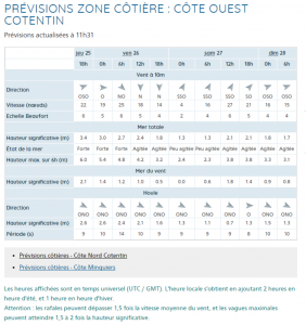
All that said, the Internet source of weather in France is Meteo France which has a delightfully compact and very informative meteogram for all the important coastal areas.
Similarly in Ireland, Met Eirann has an excellent website which includes a number of weather buoys in the Irish Sea and the Atlantic. It is very helpful to know the conditions at these points before setting out from (say) the Scilly Isles to Kinsale. Irish coastguard repeat the forecast every 3 hours, going clockwise round the whole of Ireland. It pays to have a chart showing the headlands they use to describe the forecast areas.
Dairne and I have never made an ocean passage. The nearest we have come to that is to sail my son’s 40ft cutter, True, along the New Zealand coast. It is a country which is so isolated that its weather is, in effect, ocean weather (the nearest countries are Fiji and Tonga about 1000 miles away!
Nearly all of what I know about ocean weather I have learned from Frank Singleton. Frank was a senior forecaster in the Met Office and, through his membership of the Cruising Association, was critically influential in developing the weather forecasts and information available to the leisure boating community. His website is also teamed up and supported by Mailasail who provide a wonderful Grib service available via long range radio (SSB and satphone such as iridium). If you are contemplating going offshore there can be no better advice than to study the Mailasail website and note the advice given by Frank Singleton Click here to see his home page
When I last looked, Frank had returned from a few years exploring the Med and has had a couple of seasons tramping over the Biscay sun, seafood and wine route from a Dartmouth base. He is still updating his website and campaigning to maintain the standards of weather information available to all yachtsmen. We owe him a lot.
Another invaluable ocean site is called Noonsite
At the root of the weather data we use is the GMDSS service (Global Maritime Distress and Safety System). On his web page, Frank states “The value of the GMDSS and the necessity to use it cannot be overstressed. Forecasts and warnings are necessarily very broad brush but they do have the inestimable value of human, intelligent input. Experienced forecasters can give the best interpretation of the guidance from Numerical Weather Prediction models. They can see the output from models run by other Met services and from their own computer run under slightly varying initial conditions (known as ensembles). The best use of forecasts is to study both the GMDSS text forecasts and other data such as GRIB files and synoptic charts.”
I have downloaded forecast charts using Mailasail, including some synoptic charts showing fronts. This is particularly important in the Pacific. Distances are so great that Single Sideband Radio (SSB) is common. We had SSB on True and we could get weather maps from Wellington NZ and from Australia. If I were ocean sailing I would not be without SSB, even if I carried a satphone. If you plan to go to the west coasts of Ireland, or Scotland, Then SSB and Mailasail grib delivery are very comforting because mobile phone, Internet and VHF signals cannot be relied upon

